Engage Logo
    • Uitgebreid zoeken
  • Gast
    • Inloggen
    • Registereren
    • Nachtstand
Satpalda Geospatial Service Provider Cover Image
User Image
Sleep naar de juiste positie
Satpalda Geospatial Service Provider Profile Picture
Satpalda Geospatial Service Provider
  • Tijdlijn
  • Groepen
  • Respects
  • Vrienden
  • Foto's
  • Video's
Satpalda Geospatial Service Provider profile picture
Satpalda Geospatial Service Provider
2 jr - Vertalen

https://satpalda.co/ground-penetrating-radar-gpr/

Ground Penetrating Radar (GPR) | GPR Applications
satpalda.co

Ground Penetrating Radar (GPR) | GPR Applications

Ground Penetrating Radar (GPR) is one such innovative technology. By looking beneath the surface of the Earth, this state-of-the-art technology provides a unique perspective that goes beyond typical GIS tools.
Respect!
Kommentar
Delen
Satpalda Geospatial Service Provider profile picture
Satpalda Geospatial Service Provider
2 jr - Vertalen

https://satpalda.co/encroachment-detection/

Encroachment Detection
satpalda.co

Encroachment Detection

encroachment detection have emerged as critical responsibilities for land administration, infrastructure development, and urban planning.
Respect!
Kommentar
Delen
Satpalda Geospatial Service Provider profile picture
Satpalda Geospatial Service Provider
2 jr - Vertalen

https://satpalda.co/geospatial....-technology-used-for

Respect!
Kommentar
Delen
Satpalda Geospatial Service Provider profile picture
Satpalda Geospatial Service Provider
2 jr - Vertalen

https://satpalda.co/railway-corridor-mapping/

Railway Corridor Mapping - SATPALDA
satpalda.co

Railway Corridor Mapping - SATPALDA

The process of producing precise and in-depth spatial representations of railroad infrastructure and its surroundings is known as "railway corridor mapping.
Respect!
Kommentar
Delen
Satpalda Geospatial Service Provider profile picture
Satpalda Geospatial Service Provider
2 jr - Vertalen

https://satpalda.co/gis-applic....ations-in-civil-engi

GIS Applications in Civil Engineering
satpalda.co

GIS Applications in Civil Engineering

Geographic Information System GIS technology is now widely used in many different industries with significant applications in civil engineering and the spatial viewpoint provided by GIS improves the planning, design, building and maintenance of civil
Respect!
Kommentar
Delen
 Laad meer berichten
    info
  • 11 posts
  • https://satpalda.co/kazeo-sat/

  • Man
  • 01/01/91
  • Leven in United Arab Emirates
  • Gelegen in uae
About

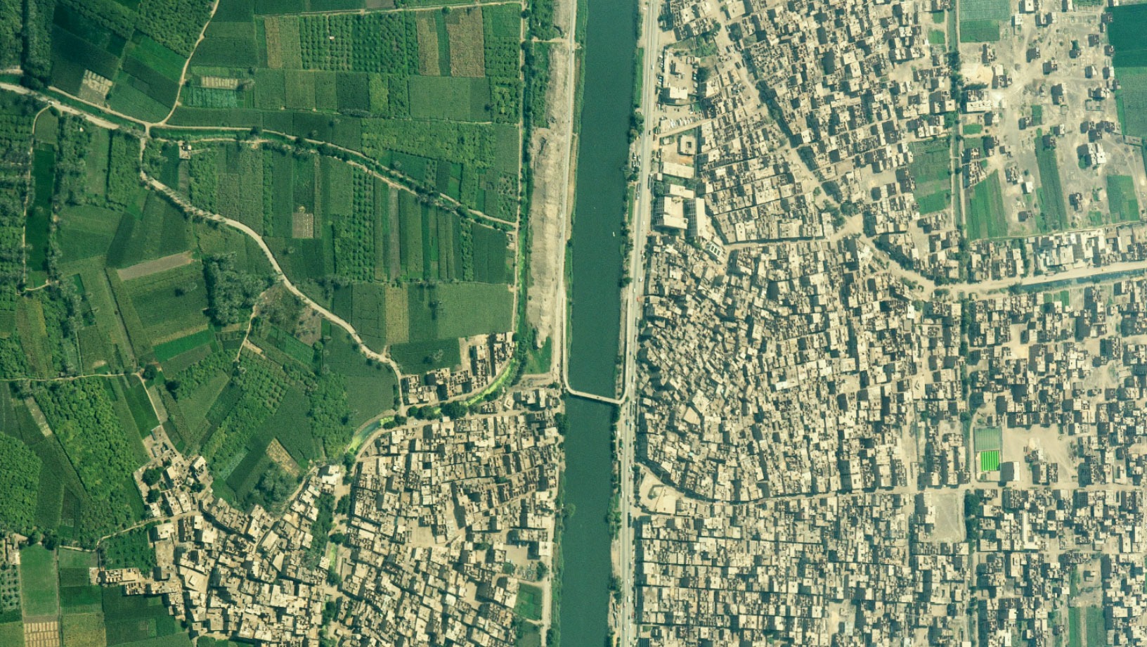
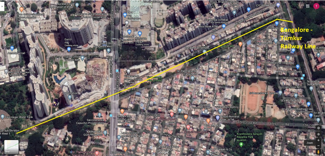
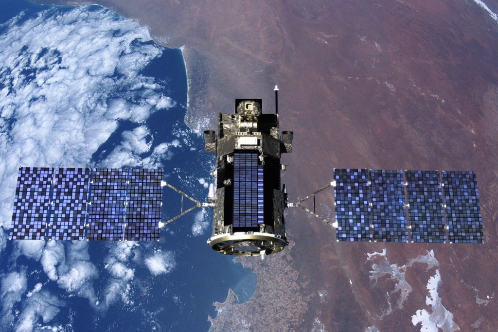
SATPALDA| Satellite Imagery and Geospatial Solutions - We provide high-resolution and high-frequency satellite imagery and geospatial data services. Satpalda Geospatial Services is a leading provider of satellite imagery and geospatial services and solutions.

    Albums 
    0
    Vrienden 
    1
  • Danny Huff
    Respects 
    0
    Groepen 
    0

© 2025 Engage

Language
  • English
  • Arabic
  • Dutch
  • French
  • German
  • Italian
  • Portuguese
  • Russian
  • Spanish
  • Turkish

  • About
  • Contact Us
  • Developers
  • Meer
    • Privacy Policy
    • Terms of Use
    • Verzoek om terugbetaling

Unfriend

Weet je zeker dat je wilt ontvrienden?

Rapporteer deze gebruiker

Belangrijk!

Weet u zeker dat u dit lid van uw familie wilt verwijderen?

Je hebt geplooid Satpalda

Nieuw lid is succesvol toegevoegd aan je familielijst!

Snijd je avatar bij

avatar

© 2025 Engage

  • Home
  • About
  • Contact Us
  • Privacy Policy
  • Terms of Use
  • Verzoek om terugbetaling
  • Developers
Language
  • English
  • Arabic
  • Dutch
  • French
  • German
  • Italian
  • Portuguese
  • Russian
  • Spanish
  • Turkish

© 2025 Engage

  • Home
  • About
  • Contact Us
  • Privacy Policy
  • Terms of Use
  • Verzoek om terugbetaling
  • Developers
Language
  • English
  • Arabic
  • Dutch
  • French
  • German
  • Italian
  • Portuguese
  • Russian
  • Spanish
  • Turkish

Reactie succesvol gerapporteerd.

Post is succesvol toegevoegd aan je tijdlijn!

U heeft uw limiet van 5000 vrienden bereikt!

Bestandsgrootte fout: Het bestand overschrijdt de limiet toegestaan ​​(954 MB) en kan niet worden geüpload.

Je video wordt verwerkt, we laten je weten wanneer het klaar is om te bekijken.

Kan een bestand niet uploaden: dit bestandstype wordt niet ondersteund.

We hebben een aantal inhoud voor volwassenen gevonden in de afbeelding die je hebt geüpload. Daarom hebben we je uploadproces geweigerd.

Deel bericht over een groep

Deel naar een pagina

Deel met gebruiker

Je bericht is verzonden. We zullen je inhoud binnenkort beoordelen.

Om afbeeldingen, videos en audiobestanden te uploaden, moet je upgraden naar pro-lid. Upgraden naar Pro

Aanbieding bewerken

0%